The wonderful, laid-back holiday village of Wooli and Minnie Water are located on the Clarence Coast in Northern New South Wales, Australia, and completely surrounded by Yuraygir National Park.
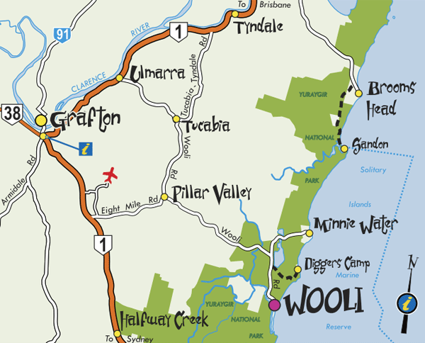
From the south: turn off the Pacific Highway 12 km south of Grafton onto Wooli/Grafton Airport Road and follow the sign-posted route (30 minutes).
From the north: access is via the Pacific Highway intersection at Tyndale and via Tucabia (30 minutes).
Driving distances from major cities are at the bottom of this page.
Tourism map: region between Grafton and Wooli, Diggers Camp, Minnie Water

Or use the interactive features of this Google Map:
Driving distances to Wooli
- From Grafton NSW – 47 km -> 35 mins
- From Coffs Harbour NSW – 105 km -> 1 hr 20 mins
- From Byron Bay NSW – 227 km -> 3 hrs
- From Gold Coast QLD – 304 km -> 4 hrs
- From Brisbane QLD – 380 km -> 4.5 hrs
- From Sydney NSW – 635 km -> 7 hrs